
3DGEm cuts the uncertainties!
Map the structures and geologic units with high spatial and data resolution. Spend more time managing your geo-resources more efficiently!
Creating 3D Geologic maps using Electromagnetics.
About
About 3DGEm
Advantage
The 3DGEm Advantage
3DGEm system has low environmental footprint and produces high-resolution 3D subsurface images for various applications including mineral exploration, environmental studies, and geotechnical investigations.
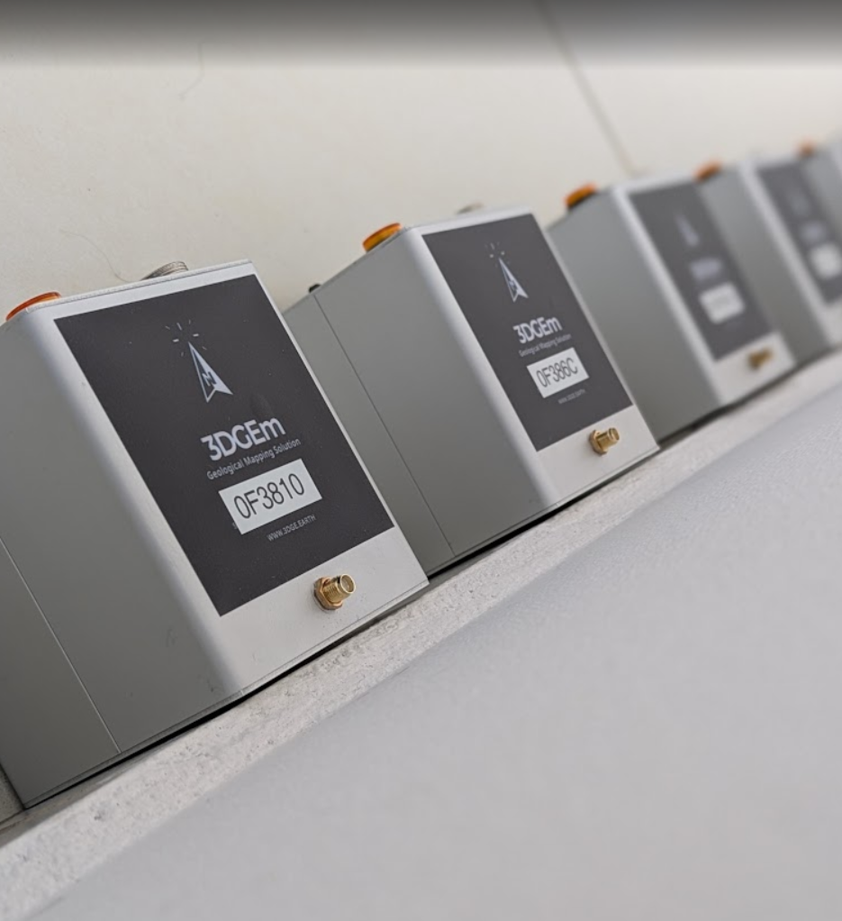
Nodal, Portable, Easy field surveys
3DGEm’s lightweight wireless nodes are small, 5v powered units, installed easily in the field; and collects data down to a few km within few hours of recording. Geophysicists and geologists can now spend more time appreciating their discoveries!
Passive, Non-invasive, Low footprint
3DGEm is non-invasive, passively recording the natural electromagnetic signals without disrupting the surroundings. Very user friendly requiring only a compass for the field crew to install! No cables; no digging; no cutting of vegetation. Truly insignificant environmental footprint!
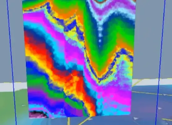
High resolution, Flexible scale, Geological output
With 30 nodal units spread over the area of interest, 3DGEm creates a high-density data cloud from which 3D geological maps are created. Can cover a few km2 area and a few km depth in a single 24 hour episode of survey. Geologists quickly benefit from the high resolution 3D structural maps; explorationists benefit from the multi-spectral charts that correlate with ground and subsurface samples.
Multi-spectral, Multi-physics, Muti-temporal 3D imaging
3DGEm creates multi-channel 3D charts of the subsurface geological heterogeneity. Multi-spectral charts correlate with various physical and chemical parameters to suit a wide array of applications, including high-resolution change detection in 3D space.
Steerable focus & coverage, Deep penetration
For partially known areas, 3DGEm surveys can focus on specific areas and depth targets. 3DGEm can also create synoptic images of green fields, allowing the data to reveal new discoveries, even under thick overburden and down to few kilometers depth.
Locally-tuned intuitive results, Correlates with external data
3DGEm's simultaneous group data records are tuned to the ambient local conditions. The qualitative results create intuitive images that resemble familiar geological maps, revealing structures and geological features otherwise unseen by other methods. 3DGEm makes a good complementary tool in any geological mapping venture.
Applications
3DGEm Applications
3DGEm's high-resolution subsurface imaging capabilities make it suitable for mineral exploration, environmental studies, geotechnical investigations, and many more!
Geologic structures
3DGEm images a naturally-anisotropic inductance index that faithfully displays faults and near-vertical geological discontinuities.
Learn More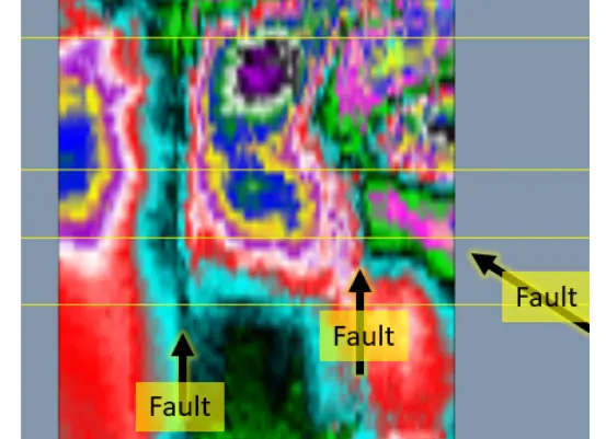
Geologic materials
3DGEm’s highly sensitive impedance coefficient charts lithological, geochemical and various hydrodynamic features of the subsurface.
Learn More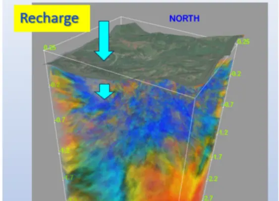
Hydrogeology
The high-resolution multi-channel outputs can reveal fluid migration channels and the interaction between groundwater, geology and rock geochemistry.
Learn More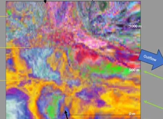
Geochemistry
The multi-channel thematic 3DGEm charts reflect geological variations likely related to the overall geochemical composition of the materials encountered in the subsurface.
Learn More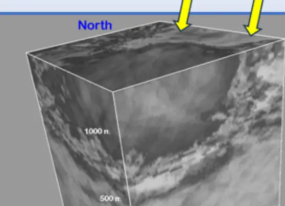
Geohazards & environment
Faults, landslides and other structures that can fail can be mapped by 3DGEm. Geochemical features of flowing groundwater can be charted.
Learn More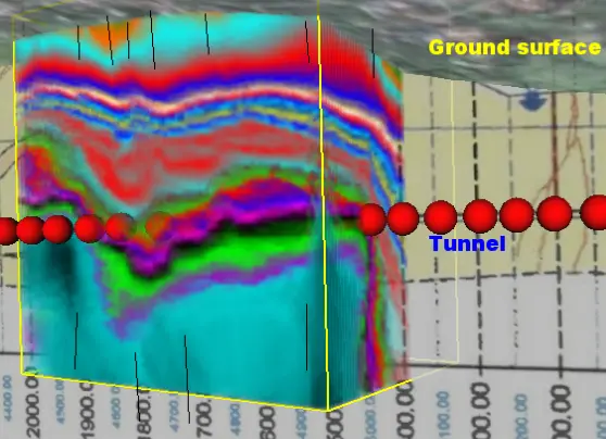
Civil structures
Geological conditions that can threaten projects can be mapped. Internal faults of massive built structures can be charted.
Learn More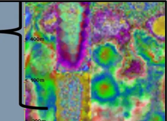
Minerals
Lithological and geochemical anomalies can be mapped in 3D and validated surface and drilling samples.
Learn More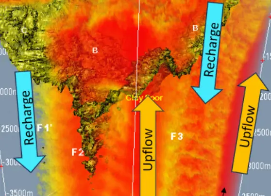
Geothermics
The response of electrical inductance and impedance to subsurface thermodynamics is incorporated int the 3DGEm data. The geometry of warm and cold regions can be estimated.
Learn More
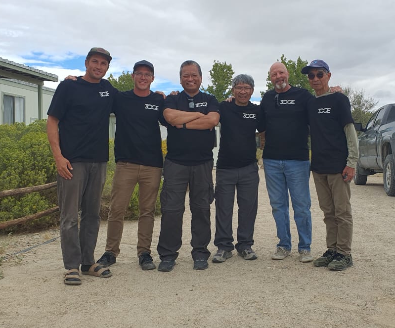
Team
3DGEm Team
Choosing 3D EDGE means partnering with a team dedicated to innovation, expertise, and client success. Our unique approach combines cutting-edge technology with deep industry knowledge to deliver unparalleled results.
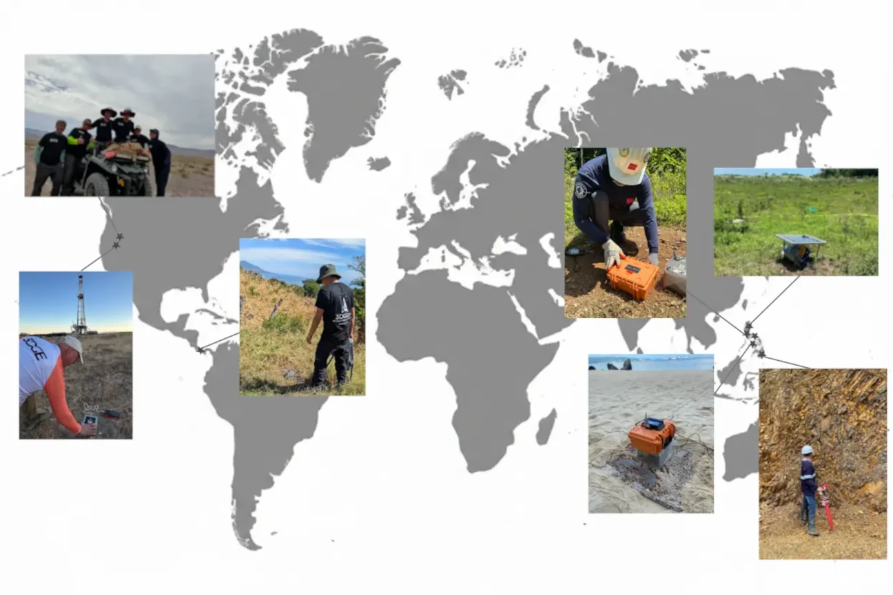
Portfolio
3DGEm Deployments
Different geological settings 3DGEm deployed to across the world.
Contact
Contact 3DGEm Team
Interested in learning more about 3DGEm? Contact us to discuss how our innovative geophysical solutions can meet your needs and help you achieve your goals.
Email us at
info@3dge.earth